|
|
 |
Knowledge Is Key
For Intelligent Decisions
Satellite Logic is a leading,
authoritative source of information in
the Satellite Industry. Located in the
heart of the Silicon Valley, Satellite
Logic provides one of the most
valuable and comprehensive
knowledge bases on the Satellite
market! This is a primary Worldwide
information center which enables our
clients to analyze, evaluate, inquire
and select their best tailored
solutions. Our company sets the
industry standards for targeted
buying leads, reflecting a dramatic
advance over traditional marketing
solutions.
|
|
|
 |

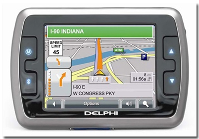
If you have bought a new GPS receiver, you already know it wasn't
an easy decision. But now there is another important decision you'll
have to make - which navigation software you should buy for your
new GPS. That is unless your new GPS already includes software as
a package kit.
Assuming you're now looking for navigation software, you'll want to
buy something that fits your specific use. In other words, the
software that you'll buy will have to include the layout, information,
and map support you need for what you intend to use it for.
Obviously if you are a local taxi driver, your needs are different than
the needs of a truck driver or the needs of a family that travels
around the country.
As you'll see on this page, there are a lot of considerations to make
before making a final decision. Nevertheless, the best thing would
be to choose any software that is easy to use, but with enough
features to configure it for your needs.
General Features to Take In Consideration
Maps. Built-in basic maps, with optional changeable maps wherever
possible. There are basically three areas covered by basemaps: the
Americas, Europe/Africa, and the Pacific region. These come in two
sizes, one contains basically only the freeway system and a second,
more complete larger one, contains all of the cities and most of the
roads between cities as well as major roads within the cites. The
maps usually include auto-routing data. Keep in mind though that
most units do not allow you to change the basemaps.
Input. The way the software will operate the navigation system.
One hand operation should be best because you may need to
operate your navigation receiver while driving. Voice commands and
voice recognition are highly useful in this respect. Both of these
control inputs are important for keeping your hands on the wheel.
Touch screens can be important because they allow more intuitive
control over the device and the ability to present more controllable
options at once. A touch screen can help you perform complex actions
you couldn't do with simple controls. Some touch screens have bump-
generating tactile surfaces for simulating the "feel" of buttons and
controls on the screen.
Output & Export. The software should enable you to export settings
for backup or sharing purposes. Waypoints, tracking information, and
configurations should be exportable for use with external software,
cataloging, migration, or backup purposes. Since most devices have
a cable that you can connect to the computer, the best way would be
to export data wirelessly.
Import Data. The same as above, but the opposite way. Sometimes
you need to be able to import settings for restore or sharing
purposes. Fast and easy destination address entry is important and
is accomplished with a well-designed control input. Integrating the
contact and address information from a personal address book or
the ability to import such information to store addresses by name for
fast and easy lookup is a very handy feature to have.
User Friendly. The device should be easy to understand and
operate. It should be intuitively clear and detailed.
Information Display. There are many ways to display the
requested information. The system may use a video display or voice
prompts, though the video is the most beneficial mode. A map screen
is obviously much easier, allowing you to see where you are relative
to reference waypoints. A map screen should be laid out for optimum
viewing of the map and include a distance indicator, showing
uniquely identified objects and colors or shades. It should let you
add a track line to the display. Pop-up display prompts on the
displays themselves are additional handy outputs of information. Text
directions should be viewable in addition to or instead of using a map
screen. The text itself should have a combination of large numbers to
represent important information and small numbers for less important
information that only a navigator would really look at.
Voice Prompts. Voice prompts are an important supplemental
information output tool because they allow you to pay attention to
the road so you don't have to read the display while driving. Voice
directions should be clear and in your language. Most systems will
deliver the voice information ahead of time to make a safe driving
decision and maneuver. Also, voice instructions that communicate the
distance, the name of cross streets and your turn street, and the
direction of the next turn do so automatically as you approach each
turn with a clear and comforting voice. You should be able to turn
these sounds off. Also there should be a day and night mode with
different contrast levels and this can happen automatically or
manually and should be able to be switched off.
Map Orientation. Either North up or Track up. This is based on your
preference and how you read a map. Some people always like North
at the top which immediately clues you in to your current direction
and some people like the road ahead at the top of the screen, though
you will need to look at direction indicators to find out what your
current heading is.
Map Scrolling. You should be able to scroll around the map separate
from your current position and bring up the ETA and distance to the
location of the pointer on the map.
Map Support. When you buy navigation software for your Palm
Powered device, look for software that allows different types of maps
to be loaded into the software. Map sources are incredibly important
when selecting a navigation device, because the quality of the
source influences the final product. Almost all navigation software
will only work with maps provided by the manufacturer of the
software, but some navigation software will let you load in your
own maps. There are only three main providers of road map data
and about 95% of navigation software manufacturers use the data
from Navteq. Road maps include routing information and the routing
accuracy while using these maps depends more on the software
application, GPS receiver accuracy, and GPS signal strength.
Memory. Make sure your Palm Powered or GPS device has enough
memory to load these extra maps. Usually 32MB-128MB is sufficient
for map information, especially for Point-Of-Interest (POI) information
and detailed street data, but you will still want more memory for
other data and applications. You should be able to fit a full state or
two with all details in this amount of memory. A minimum of 8MB of
map memory is recommended for a couple maps, though you can
"get by" with about 2MB for a basic and/or small map. Since maps
can change moderately every year or so and significantly every few
years, realize that you will want to purchase updated maps at least
once before the useful lifespan of your Palm Powered or GPS device
is up.
Routes. A route is the path that you take from your source location
to your destination location and routing is the feature that figures
out how to best connect the two locations. Routes are like tracks, but
they are created ahead of time for the route ahead of you instead of
the path behind you of where you have been which is called a track.
Routes usually consist of addresses, waypoints, and POIs. Twenty to
fifty route capability is pretty standard on GPS devices and navigation
software today, though routes are often limited to how many
waypoints they can each hold. You should also be able to reverse all
of these routes, but that may not help you with some driving and
boating lanes. Routing information combined with your current speed
can provide an Estimated Time of Arrival (ETA). Routing should take
into account one-way roads so that it doesn't send you in the wrong
direction, but the GPS device or navigation software should have the
ability to turn off one-way road routing when you are traveling on foot
or bike. The device should allow you to route to "home" easily. Finally,
you should be able to also stop and resume a route.
Routing. This allows you to calculate routes from a new source
location and/or to a new destination location dynamically on your
device as needed instead of planning out a route before you leave.
This feature is not present in low end units, but a "find address"
feature is a poor man's substitute which can then allow you to
manually plot a route on the device to your destination. Most
navigation software will also work without a GPS receiver, allowing
you to input or select two addresses and get driving or walking
directions to those locations. Almost all software today includes
dynamic address-to-address routing.
Alternate Choice. You should look for navigation software that not
only provides you with dynamic routing information, but displays
multiple alternative routes to get to that location. Viewing multiple
routes (shortest, quickest, and optional) at the same time allows you
to choose your route based on your needs and knowledge instead of
letting the software decide for you.
Automatic Re-Routing. One of the coolest features of GPS devices or
navigation software is that they can reroute your route in real time
(if you miss a turn or get lost) or find a shortcut around a traffic jam,
saving you a lot of time. You can automatically be rerouted when you
deviate from the planned route and most units have this. This should
be a feature that can be automatically activated if you go off route or
by an integrated traffic condition/construction/detour system (like RDS
radio broadcasts or a traffic broadcast feed from a satellite or the
Internet). You should still be able to manually activate rerouting
through a menu or turn off automatic rerouting for the current trip, a
time period, or permanently.
Satellite Information. The software should be able to show you the
quantity of satellites in view, the signal strength and position on the
horizon of every satellite, when it has locked on to the satellite and
the accuracy, date, time, and ID (IDs can be used to find out the
satallites' capabilities) of each satellite.
Security. Devices should be lockable against accidental button
pushes and information should be secured so that only people with
authorized access can access personal information stored on your
device, like where you have gone, the waypoints you have marked,
and address information that you have entered into the device.
Tracks. Tracks are like automatic temporary waypoints of where you
have been, but they don't tell you where you are going. Make sure
your GPS device or navigation software supports enough tracks and
that they will provide enough distance for you to save the complete
route. Thousands of points are usually maintained for an automatic
track log and a few tracks can even be saved sometimes. Most
devices should be able to export and import tracks. Track properties
include location, speed, heading, and time. Usually you specify how
often tracks are created to suite the level of detail for your average
speed (walking vs. driving).
Traffic Condition. This new feature covers traffic conditions,
accidents, and road construction. This can be a helpful feature to
have if you know you have more than one route that you can take to
get to your destination. Only a couple dozen major cities are
supported at this time and information can still be a little spotty and
unreliable, but more cities will be added and more reliable reporting
will eventually come, but your software should work with these
types of updates.
Trip Computer. Odometer, average speed, moving time, total time,
maximum speed, etc
You should be able to save trip information.
Waypoints. Waypoints are the coordinates (latitude and longitude)
on the map with special meaning. They are neither where you have
been or where you are going. They are just there and can be used as
a reference. Expect the device to handle a few hundred to a few
thousand waypoints. You should be able to easily mark your current
location which will create a waypoint and save that location for
future reference. You should also be able to mark waypoints based
on coordinates. Waypoints can usually be given names and symbols
for easy identification. Modern GPS receivers can accept six character
waypoint IDs or longer. Waypoints should be able to be organized
into common and customized categories. Most devices should be able
to export and import waypoints.
Additional Features. Address integration, alarms, area calculation,
electronic compass, geocashing navigation, web access and so on.
|
|
|
|