|
|
 |
Knowledge Is Key
For Intelligent Decisions
Satellite Logic is a leading,
authoritative source of information in
the Satellite Industry. Located in the
heart of the Silicon Valley, Satellite
Logic provides one of the most
valuable and comprehensive
knowledge bases on the Satellite
market! This is a primary Worldwide
information center which enables our
clients to analyze, evaluate, inquire
and select their best tailored
solutions. Our company sets the
industry standards for targeted
buying leads, reflecting a dramatic
advance over traditional marketing
solutions.
|
|
|
 |

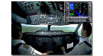
Aviation GPS is extensively used in the aviation community. Aviators
throughout the world are using satellites to overcome many of the
deficiencies in today's air traffic infrastructure. With its accurate,
continuous, all-weather, three (GPS only) and four (GPS with
augmentations) dimensional coverage, satellite navigation offers an
initial navigation service that satisfies many of the requirements of
aviation users worldwide. Unlike the current ground-based devices
and equipment, GPS navigation permits accurate aircraft position
determination anywhere on the surface of the earth.
One of the recent programs that has been designed to manage air
traffic is developed through the GNSS. The GNSS Program Office is
working to successfully field a GPS-based navigation capability in the
United States to cover all phases of flight from enroute through
surface navigation. The FAA is working to overcome the deficiencies
in today's air traffic infrastructure and guide the future of the United
States' National Airspace System (NAS). To do this, the FAA is
developing two satellite-based systems, the Wide Area
Augmentation System (WAAS) and the Local Area Augmentation
System (LAAS), which will provide the accuracy, availability, and
integrity needed to use GPS as a primary means of navigation in
the NAS. These systems will provide accurate, continuous, and all-
weather coverage to satisfy today's aviation needs. The GNSS Team,
along with other FAA organizations and numerous governmental and
non-governmental agencies, aims to pave the way for a smooth
transition to satellite navigation.
Aviation navigators, equipped with GPS receivers, use satellites as
precise reference points to trilaterate the aircraft's position. GPS is
already providing benefits to aviation users, but relative to its
potential, these benefits are just at their beginning. The foreseen
contributions of GPS to aviation promise to be revolutionary. With
air travel nearly doubled in the 21st Century, GPS can provide a
cornerstone of the future air traffic management (ATM) system that
will maintain high levels of safety, while reducing delays and
increasing airway capacity. To promote this future ATM system, the
FAA's objective is to establish and maintain a satellite-based
navigation capability for all phases of flight.

The extensive use of satellite navigation technologies provides
substantial benefits to both the providers of such services in the
region, as well as the individual and combined user communities. The
implementation of this technology in a country or region provides the
following benefits to aviation transportation:
* Enhanced safety of flight throughout the region
* Seamless navigation service based on a standardized navigation
service and common avionics
* More efficient, optimized, flexible, and user-preferred route
structures
* Increased system capacity
* Reduced separation minimums resulting in increased capacity and
capabilities
* Significant savings from shortened flight times and reduced fuel
consumption
* Reduced costs to each individual State while increasing overall
benefits to individual States and the entire region
* Further economies from reduced maintenance and operation of
unnecessary ground-based systems
* Improved ground and cockpit situational awareness
* Increased landing capacity for aircraft and helicopters
Additionally, the implementation of this technology adds a margin of
safety to operations within the expected coverage area by providing
four-dimensional positioning, as opposed to the two-dimensional
positioning of traditional systems. This reduces accidents by providing
a consistent navigation capability that does not change, regardless
of location, replacing major portions of current ground-based
navigation infrastructures, and simplifying avionics suites. It also
offers a precision approach capability at any airport within that
region. All aircraft equipped with certified GPS/WAAS receivers have
the needed accuracy, integrity, and availability for them to use GPS
as a primary navigation aid, and thus experience the benefits of
seamless travel.
GPS is common in light aircraft cockpits and GPS systems are certified
for en route IFR as well as nonprecision approaches. The FAA has put
together a phase out plan for most non-GPS forms of electronic
navigation. GPS can not be used as the only means of navigation
until GPS III when all the satellites are replaced. This project will not
yield benefits until at least 2011. The FAA has granted pilots who
navigate in oceanic airspace and selected remote areas the approval
to use GPS as the only means for navigation. Also, aircraft equipped
with a WAAS-enabled receiver can use WAAS as a primary means of
navigation.
Accuracy for most aviation GPS receivers is less than 15 meters and if
the unit has WAAS, accuracy can be less than 3 meters. Receiver
Autonomous Integrity Monitoring (RAIM) is protection against GPS
errors. RAIM is mandatory on all IFR approved GPS receivers. RAIM
works by determining position using at least five satellites or four
satellites and barometric altitude input from an altimeter. The unit
will give an alarm if it senses that one or more satellites is
transmitting questionable data.
There is no doubt that the aviation industry will keep relying on GPS
navigation, while developing more sophisticated devices and tools.
In this field it seems that sky is not the limit, but the start.
|
|
|
|
