|
|
 |
Knowledge Is Key
For Intelligent Decisions
Satellite Logic is a leading,
authoritative source of information in
the Satellite Industry. Located in the
heart of the Silicon Valley, Satellite
Logic provides one of the most
valuable and comprehensive
knowledge bases on the Satellite
market! This is a primary Worldwide
information center which enables our
clients to analyze, evaluate, inquire
and select their best tailored
solutions. Our company sets the
industry standards for targeted
buying leads, reflecting a dramatic
advance over traditional marketing
solutions.
|
|
|
 |

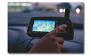
GPS receivers are now a mature technology. Finding hundreds of
applications in location and timing, and the development of new
GPS software products, we can now enjoy dramatically improved
accuracy and performance.
GPS software is an essential component for operating, monitoring
and enjoying the power of the GPS products. They can display your
waypoints, routes, and tracks on USGS topo maps and aerial photos.
Using the powerful mapping tools you can draw your route directly
on a map, search for nearby features from the millions of waypoints
available in the database, and transfer your trip directly to your GPS
in one click.
GPS software is uses Internet connection to retrieve maps as you
navigate, saving the maps to your hard drive. Disconnect your laptop
and head out on a trip, and all of your data is available. It also keeps
track of which maps need to be retrieved from the Internet, so you
can quickly define an area to map and let the software gather the
data later.
GPS software contains powerful data manipulation features, enabling
exchange of data with Excel and popular mapping programs. It can
connect your GPS to the best mapping and information sites on the
Internet, giving you one-click access to street maps, weather forecasts
and nearby attractions.
GPS Software will change the way you use your GPS to work, play,
and interact with other GPS users. You'll discover a whole new view
of the world with aerial photos and maps.
A new trend is to produce SatNav software for mobile phones. This
started with Wayfinder using a download service, but has grown over
the last 18 months and the variety of software available rivals
traditional PDA GPS software. Most of the major SatNav companies
have recognised the massive potential in the mobile market and have
produced Street Routing and Topographical systems for Mobile phones.
Street Routing allows you to have street maps of the location you are
in, allows you to route from your current location to a destination,
and allows you to plot routes and avoid road blocks.
GPS Software ranges in price from high-end packages costing
hundreds or even thousands of dollars, to low end programs that are
often free. The axiom here is "you get what you pay for". The high end
packages do everything the professional would ever want, but come
with a downside - they are memory hogs and have very steep learning
curves. The freeware often has very limited functionality, meaning it may
only do one thing well or work with a single brand/model of GPS
receiver.
|
|
|
|