|
|
 |
Knowledge Is Key
For Intelligent Decisions
Satellite Logic is a leading,
authoritative source of information in
the Satellite Industry. Located in the
heart of the Silicon Valley, Satellite
Logic provides one of the most
valuable and comprehensive
knowledge bases on the Satellite
market! This is a primary Worldwide
information center which enables our
clients to analyze, evaluate, inquire
and select their best tailored
solutions. Our company sets the
industry standards for targeted
buying leads, reflecting a dramatic
advance over traditional marketing
solutions.
|
|
|
 |

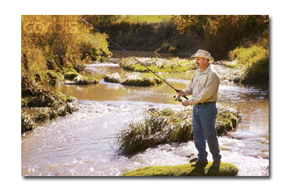
Being a fishman these days means that productivity and efficiency
come hand in hand with your ability to read a map. It is important to
be able to read a map and understand the depths of the lake
correctly in order to determine the route of the fish as well as the
feeding grounds. Reading a map before heading out to fish means
that you also have to spend more time fishing in the active areas
and not just cast out blindy. Take the time to learn to read maps
properly to make the most use out of your time out fishing.
Depth breaks are represented by clear lines on the map. Each of
those lines symbolizes changes in the water's depth. Using these
lines on the map, you can easily find the desired depth for your
fishing needs. Keep in mind that during warmer climates the fish
will occupy a more gradual slope while during colder times you will
see a sharper drop into the deeper parts of the lake.
Maps employ a great deal of information to a fisher including the
direction a stream will drain or if you are faceing rapids or waterfalls.
Maps can also show you the quickest routes home if you look hard
enough.
Marine Charts are concidered the best specialized maps for the
fishing enthusiasts. These charts offer critical information for fishers
and boaters including shifting shoals and sandbars. Make sure to
get updated charts on an annual basis as the represented
information shift and change often.
The benefits of fising gps are numerous. A global positioning system,
or GPS, has become an essential tool for productive fishers looking
primarily for the spoils of the game. The GPS is the most accurate
navigational method available on the market as it tells you where
you are at all times.Spending some time planning with a map and
GPS will produce a fishing expedition with minimal time wasted and
more time actually fishing. A GPS is especially useful when fishing in
a remote region and characterless bodies of water.
Get the most out of your GPS units by getting digital charts or
scanning paper maps with a mapping software. Then you just enter
your suitable way points throughout your desired fishing route.
With the constant shifting and changes to the water bottom, there
are always great fishing spots that will be hidden from older maps
as oppose to an always updated GPS. A bonus with using a GPS
when fishing is that you can use the unit to mark fishing hot spots
that you may run into for future outings or for sharing the
coordinates with a fishing buddy.
A GPS unit is also a great tool that will let you find your way back to
the shore easily so you can better enjoy the fishing without worrying
about navigation. GPS units provide the fisher with all the
navigational information needed incluing position, direction, bearing,
speed and even time to destination.
GPS units allows fishers and boaters to navigate the waters safely
even when hit with heavy fog or other bad visibility conditions. Heck,
even when the day is clear it's very easy to lose your sense of
direction when out in the open seas but with a GPS unit you always
know where you are and where your headed.
The GPS mapping software makes it quick and easy to find your way
to the nearest dock or port if you need to find your way to one in a
hurry. The precision of GPS units also allows you to communicate
exact positions to a Coast Guard or rescue crew if the need arises.
Emergencies in the sea greatly relies on quick and accurate
navigation to diffuse the situation.
So if you are a fishing enthusiast, you do not need to be limited by
fishing holes that you know of. Instead consider using a fishing GPS
device along with custom maps (that are available freely via
download from local park websites), which can serve as a virtual
guide for your fishing trip in an unfamiliar area.
|
|
|
|