|
|
 |
Knowledge Is Key
For Intelligent Decisions
Satellite Logic is a leading,
authoritative source of information in
the Satellite Industry. Located in the
heart of the Silicon Valley, Satellite
Logic provides one of the most
valuable and comprehensive
knowledge bases on the Satellite
market! This is a primary Worldwide
information center which enables our
clients to analyze, evaluate, inquire
and select their best tailored
solutions. Our company sets the
industry standards for targeted
buying leads, reflecting a dramatic
advance over traditional marketing
solutions.
|
|
|
 |

GPS for Mac users is no longer a dream. Today, Macintosh users can
also enjoy the many benefits of the GPS devices. With the right
software you can transfer waypoints and tracks, work with your
data, and even run MapSource to transfer maps. Here's what you
have to do in order to get your Mac running with GPS.
First, you need to get connected. If you have a Garmin GPS for
example, that supports USB, then it's easy. Just plug your GPS and
Mac together. There are no drivers to install. Older GPS receivers
that have serial ports will need a USB to serial adapter and its
associated drivers. KeySpan makes an adapter that will work. It
allows you to plug your Garmin serial cable into your Mac USB port.
If you have to transfer Waypoints, Tracks, and Routes - now that
your GPS and Mac are connected, you can transfer data from the
GPS and view it in Google Earth. You can use a free program called
GPSBabel to transfer the data. When you visit the GPSBabel site, go
to the downloads section and download the .dmg file for Mac OSX.
There is no installer, and you cannot simply drag the application to
your Applications folder. What you can do is to create a folder called
GPSBabel and put the contents of the disk image there.
Now, you need to transfer data from your GPS. To transfer data to
and from your GPS, make sure its connected to your Mac and start
GPSBabel. You should select the following options:
* Operating Mode: Select Waypoints, Tracks, Routes as desired
* Input Options: Select Use GPS Receiver, and select the port. In my
case I selected USB.
* Output Options: Select Use File, and for Type I selected Google
Earth because thats where I want to use my data.
* Filters: You dont need to select anything
Once you have your options selected, click Save File at the bottom.
Your data will be transferred from your GPS into the file you specified.
To load your data into Google Earth, select File, Open, and find the
file you created using GPSBabel. Google Earth will load and display
all of your waypoints and tracks. They will be listed in your My Places
section on the left. There you can enable or disable the parts youre
interested in. In my case, I disabled the track points to reduce clutter.
If you upgrade to the $20 Google Earth Plus youll be able to import
data directly into Google Earth and skip the GPSBabel step. However,
youll still need to use GPSBabel to transfer data to your GPS.
To transfer files to your GPS, Google Earth is a good tool for creating
that data. Google Earth will let you create tracks and waypoints,
then save the data so GPSBabel can transfer it to your GPS. Its a
good idea to organize your data using folders in the My Places
section of Google Earth. When you have data in folders, you can
save just that folder instead of everything in Google Earth.
To save the data just right click (or control + click if you dont have a
Mighty Mouse) on your folder and select Save As. It doesnt matter
which file type you choose. GPSBabel will figure it out. Once your
data is saved, go back to GPSBabel and set it up like this:
* Operating Mode: Select Waypoints, Tracks, Routes as desired
* Input Options: Select Use File, then click the Select button and find
the file you saved from Google Earth
* Output Options: Select Use GPS Receiver and select the proper port
* Filters: You dont need to select anything
Make sure your GPS is connected and click Send GPS at the bottom.
The data should now appear on your GPS. Youll notice that Google
Earth doesnt let you pick the nice Garmin waypoint icons, so the
icons will be generic.
Uploading maps to your GPS receiver requires MapSource, which is
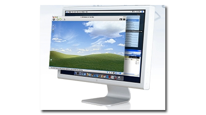
only available under Windows. If you have a G4 or G5 Mac you can
try running MapSource under Virtual PC. Its the only way if you dont
have an Intel based Mac. Running MapSource on Intel Macs is pretty
easy, and works flawlessly. There are two ways to do it:
* Install BootCamp and dual-boot between OSX and Windows XP.
* Buy Parallels Desktop and run Windows XP within OSX.
Dual booting is inconvenient because you have to reboot every time
you want to run MapSource, but it will run at the fastest possible
speed. Running MapSource using Parallels Desktop works really well,
and it's recommended. After you follow the Parallels documentation
and have Windows XP running, you can install MapSource just like
you would on any PC. The only extra step you need to do is tell
Windows that youve connected your GPS. Once you have it plugged
in via USB (or through the serial to USB adapter, which will require
drivers under Windows), click the USB icon on the lower right of the
Parallels window and tell it to connect your GPS. When you install
MapSource, be sure to visit Garmin and download the latest updates.
Google Earth also makes an excellent planning tool. Before going on
a trip, draw the route you want to take, and mark points of interest
along the way. To get the data to your GPS, save the data as KML,
then use GPSBabel to transfer it. If you visit a place that doesnt
show up in Google Earth, like a small state park that has trails and
campgrounds, find a more detailed map and overlay the map into
Google Earth. Its tricky, but you can make the map semi-transparent,
then resize and move the map until it lines up with landmarks that
appear on both the map and in Google Earth. Once you have the
map aligned you can draw tracks over any tails, and make waypoints
for the camp sites. You can then upload the data to your GPS.
As you can see, with the right software your Mac can be a very handy
tool for use with GPS receivers. Someday Garmin will release a
version of MapSource for OSX, but until then you can do almost
everything without it, and its still possible to run it if necessary.
|
|
|
|