|
|
 |
Knowledge Is Key
For Intelligent Decisions
Satellite Logic is a leading,
authoritative source of information in
the Satellite Industry. Located in the
heart of the Silicon Valley, Satellite
Logic provides one of the most
valuable and comprehensive
knowledge bases on the Satellite
market! This is a primary Worldwide
information center which enables our
clients to analyze, evaluate, inquire
and select their best tailored
solutions. Our company sets the
industry standards for targeted
buying leads, reflecting a dramatic
advance over traditional marketing
solutions.
|
|
|
 |

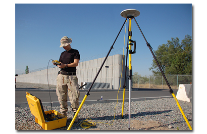
GPS surveys are surveys that are done utilizing signals received and
processed from satellites. This technology has proven very useful
for transferring information from benchmarks (known points) to a
subject site over great distances.
A major advantage of GPS survey is having the ability to make plan
maps of certain geographic sites and features with the GPS device.
The advancements in GPS technology now make it possible to create
feature maps with comparable accuracy to detailed tape and
compass maps. In most cases the level of accuracy provided by the
GPS receiver (20 to 70 cm) is the same or greater than the
discrepancy introduced by the value judgment made as to where to
place the GPS antenna to record a point. Typically, the process of
using the GPS to map smaller features, simply involves walking
around the feature's perimeter. For larger, more complex features,
the process involves mapping associated with internal or external
components, such as walls, terraces, cupboards, and pits. In either
case, the GPS data is used to print out a plan map of the feature
each measurement, to be used in the field as a template for drawing
in detailed components.
A differential GPS is the method of GPS surveying that employs more
than one GPS receiver to simultaneously collect data which will be
processed together to remove common errors. The final result of
such processing is the realization of a three-dimensional vector
between receivers. This vector can then be "added" to the known
coordinates of one of the occupied points to create a "relative"
position for the other, hence the term "relative GPS."
Differential GPS has many forms. It is often associated with Static
GPS surveying and what is commonly known as Resource Grade
Differential. However, in addition to Static GPS, most GPS surveying
techniques today use differential methods, such as Real-time
Kinematic (RTK) and Real-time Differential. Since differential
techniques are designed to mitigate errors and increase accuracy,
they are the methods of choice for most surveying applications.
Static GPS has the capability to produce relative positions at the
sub-centimeter level on relatively short distances (a few hundred
kilometers) and at the centimeter level over long distances (up to
thousands of kilometers).
The Static Technique is most often employed when conducting
control surveys, where accuracy is of primary concern. These
surveys can be conducted to establish an azimuth pair (two
intervisible marks) from which to base a conventional survey, or
many single marks over a large area for the purpose of network
or photogrammetric control. In either case, accuracy and reliability
are the key factors.
Another advantage to using the Static Technique is that if the survey
is planned properly to include existing vertical control, reliable heights
can be computed for new points in the survey, thus possibly
eliminating the need to conduct conventional leveling to support the
project.
The most important part of any GPS survey is proper planning. This
is especially true for Static GPS. Logistics play a major role in the
success of Static surveys. This is due to the fact that Static GPS
usually involves at least two (usually three or more) receivers,
collecting data simultaneously on multiple points that may be many
kilometers apart, and requiring many observation sessions.
|
|
|
|