|
|
 |
Knowledge Is Key
For Intelligent Decisions
Satellite Logic is a leading,
authoritative source of information in
the Satellite Industry. Located in the
heart of the Silicon Valley, Satellite
Logic provides one of the most
valuable and comprehensive
knowledge bases on the Satellite
market! This is a primary Worldwide
information center which enables our
clients to analyze, evaluate, inquire
and select their best tailored
solutions. Our company sets the
industry standards for targeted
buying leads, reflecting a dramatic
advance over traditional marketing
solutions.
|
|
|
 |

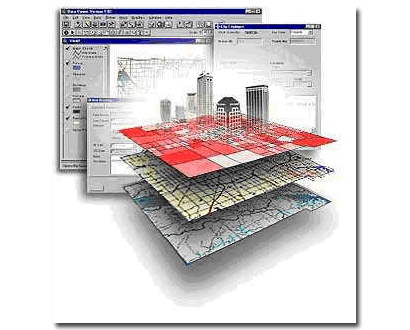
GIS is a rapidly growing technological field capable of assembling,
storing, manipulating, and displaying geographically referenced
information, meaning data identified according to their locations. This
is a computer-based tool that combines the power of a database
with the visual advantage of a map to analyze situations in such
areas as environmental protection, health care, land use, business
efficiency, education, social inequities, and much more. People often
confuse GIS with GPS because very often the points on a GIS are
determined using GPS, but they are also determined by using
existing boundaries, such as states or cities and by remote sensing
technology.
The GIS started around 1960, with the discovery that maps could be
programmed using simple code and then stored in a computer
allowing for future modification when necessary. This was a welcome
change from the era of hand cartography when maps had to be
painstakingly created by hand; even small changes required the
creation of a new map. The earliest version of a GIS was known as
computer cartography and involved simple linework to represent
land features. From that evolved the concept of overlaying different
mapped features on top of each other to determine patterns and
causes of spatial phenomenon.
GIS is used in conjunction with GPS. GPS uses 24 satellites that
orbit the earth at altitudes of 11,000 miles and transmit data to
handheld GPS receivers to pinpoint a location. GIS is composed of
computer hardware, software and spatially referenced data. The
unique feature of GIS is its ability to link spatially referenced
geometric data (e.g., latitudes and longitudes) with attribute or
descriptive information (e.g., census information, natural resources,
infrastructure or events such as frequency of traffic accidents) and
to store, manage, retrieve, and perform data analysis. Together,
the GIS GPS technologies explain how location can make a difference
in everyday life.
At the simplest level, GIS can be thought of as a high-tech equivalent
of a map. However, not only can paper maps be produced far quicker
and more efficiently, the storage of data in an easily accessible
digital format enables complex analysis and modeling not previously
possible. The reach of GIS expands into all disciplines and has been
used for such widely ranged problems as prioritizing sensitive
species habitat to determining optimal real estate locations for new
businesses.
Many people are still unaware of GIS, its capabilities and its strong
impact that is as far ranging as it is useful. GIS GPS has grown
immensely in the last 15 years, and hundreds of thousands of
people now use the technology. Although not a new GPS GIS
equipment technology, the uses of GIS GPS is expanding and the
data gleaned from this informational resource impacts our daily lives.
GPS are becoming very effective tools for GIS data capture. The GIS
user community benefits from the use of GPS for locational data
capture in various GIS applications. The GPS can easily be linked to
a laptop computer in the field, and, with appropriate software, users
can also have all their data on a common base with every little
distortion. Thus GPS can help in several aspects of construction of
accurate and timely GIS databases.
A Global Positioning System (GPS) is a set of hardware and software
designed to determine accurate locations on the earth using signals
received from selected satellites. Location data and associated
attribute data can be transferred to mapping and GIS. GPS will collect
individual points, lines and areas in any combination necessary for a
mapping or GIS project. More importantly, with GPS you can create
complex data dictionaries to accurately and efficiently collect attribute
data. This makes GPS is a very effective tool for simultaneously
collecting spatial and attribute data for use with GIS. GPS is also an
effective tool for collecting control points for use in registering base
maps when known points are not available.
Editing and display can include averaging points, connecting points
to form lines or areas, smoothing, measuring distance and area, and
displaying the data to screen. GPS software programs are not meant
to be map-making programs and usually most of the final editing will
take place in a GIS program. In the last two years, a dramatic
increase has occurred in the growth of GIS installations. This growth
is fueled by lower cost GIS entry price due to a shift from Unix-based
systems to PC-based systems. Where once expensive workstations
were required operating in a mainframe environment, the new PCs
have the power and resolution to handle GIS software.
GPS is a superior way to gather GIS data. In the past, digitizing,
scanning, field notes, photogrammetry were favored for populating
GIS systems. These data collection techniques have limitations in
terms of accuracy, attribute collection, and cost. GPS brings accurate
spatial and tabular information to GIS. As a result, increased GPS
accuracy, data collection functions, and productivity has now shifted
the balance in favor of GPS as a GIS data acquisition tool. Data
acquisition is the most costly part of a GIS system. GPS can
automate and speed data collection at lower costs with savings in
the range of 50%-60% over conventional methods. In addition, GPS
can update and maintain GIS with greater efficiency. In the future
there will be increased integration between GPS and GIS systems
with much of the work being done in the field on the spot.
|
|
|
|