|
|
 |
Knowledge Is Key
For Intelligent Decisions
Satellite Logic is a leading,
authoritative source of information in
the Satellite Industry. Located in the
heart of the Silicon Valley, Satellite
Logic provides one of the most
valuable and comprehensive
knowledge bases on the Satellite
market! This is a primary Worldwide
information center which enables our
clients to analyze, evaluate, inquire
and select their best tailored
solutions. Our company sets the
industry standards for targeted
buying leads, reflecting a dramatic
advance over traditional marketing
solutions.
|
|
|
 |

GPS devices for navigation are indeed an extraordinary, innovative
invention. Since they've penetrated the commercial market, they
became a must-have for an endless list of applications. And yet
without maps, these tools are totally useless.
A GPS receiver can indeed receive the most accurate information
about its exact location. It can even produce the best route for
driving from one point to another. But its next important task is to
present this information to the user in the most user friendly, clear
and effective way. That's why we need map software.
GPS Map Software is available for a variety of business and personal
uses. For businesses, the GPS map software enables the user to
upload all the necessary information for selling products, services
and so on. For example, a real estate agent can upload all the data
regarding homes for sale, including addresses and routes. For
travelers, the map software will display points of interest, like gas
stations, museums, ATMs, hotels, restaurants, etc. The locations are
pinpointed and driving directions provided for each one of them.
Most GPS systems are sold with mapping software for all states. GPS
Map Software is also available for marine or boating use. These maps
can be downloaded to provide valuable information such as
waypoints to correctly navigate your way back from your destination.
But you don't have to rely only on pre-loaded maps. You can create
your own maps and download them into your GPS receiver. These
can show streets, rivers, lakes, shorelines and other points of
interest. Once downloaded, they wont interfere with the GPS
receivers previously downloaded maps.
Today's GPS maps provide point of interest coordinates, map
images, route data, and track data for GPS receivers. GPS map
software is made for PDAs, laptops, desktop PCs, and specific
brands of GPS units. Manufacturers include Garmin, Magellan,
National Geographic, TopoGrafix, and DeLorme. Many GPS maps
have the capability to upload waypoints, routes, and tracks to
specific GPS units. As an example, if TopoGrafix GPS maps are
listed as having this capability with a particular model GPS receiver,
this does not mean those maps are compatible with all of that
GPS's manufacturer's products. Find out specifically about your
GPS receiver before you buy.
There are several websites that offer free GPS maps from around
the world. You can enter your preference, your planned activity (hiking,
fishing, driving, or boating), and the downloaded maps will be
managed by your software.
Here are some more resources for GPS maps.
* DeLorme GPS map enables to view maps, plot routes and
waypoints, and usually much more. Most can be used with PDAs.
* National Geographic Topo allows you to work with seamless raster
images of USGS quads.
* Fugawi enables you to create your own digital maps from any
scanned map or existing map database. Fugawi can be used without
GPS to plot positions and create a GIS database.
* MapTrax has a line of topo maps covering Australia and New
Zealand.
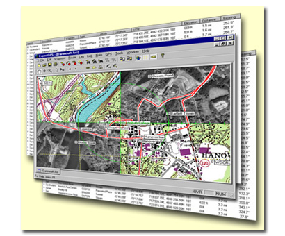
* ExpertGPS displays waypoints, routes, and tracks on USGS topo
maps and aerial photos. For use with Garmin, Magellan, and
Lowrance GPS receivers.
* Maptech's Digital ChartKit for nautical applications runs on a PC,
displaying your real-time vessel position and key navigation
information. Available areas are much of North America, Central
America, northern South America, much of Europe, South Africa, and
New Zealand.
* MapTech Outdoor Navigator includes easy download access to over
60,000 USGS topographic maps and NOAA nautical charts. For $19.95
you get the PDA software and unlimited map downloads.
* Microsoft Pocket Streets 2005 gives you GPS maps for your
Microsoft Windows Mobilebased device or Smartphone. Find points
of interest for most of North America and Western Europe.
* Brand-Specific GPS maps - Garmin has a large number of
MapSource CDs that cover city streets and metro areas, roads and
recreational points of interest, lakes and fishing spots, and topo
maps. Magellan's line of GPS maps are the MapSend series. They
have many CDs for roads and highways, city streets, topo maps,
and nautical charts.
|
|
|
|