|
|
 |
Knowledge Is Key
For Intelligent Decisions
Satellite Logic is a leading,
authoritative source of information in
the Satellite Industry. Located in the
heart of the Silicon Valley, Satellite
Logic provides one of the most
valuable and comprehensive
knowledge bases on the Satellite
market! This is a primary Worldwide
information center which enables our
clients to analyze, evaluate, inquire
and select their best tailored
solutions. Our company sets the
industry standards for targeted
buying leads, reflecting a dramatic
advance over traditional marketing
solutions.
|
|
|
 |

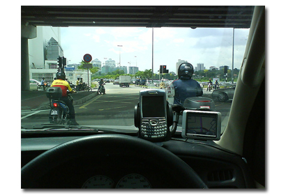
Automotive GPS devices built for cars usually include built-in maps or
at least allow you to download mapping data. Many of these devices
have voice directions so you can keep your eyes on the road, touch
screens, and mounting options.
With your very own personal automotive GPS navigator, you won't
get lost again. But with so many available options on the market,
how do you know which automotive GPS is right for your specific
needs? To start analyzing your options, here are a few important
things to consider:
* Will you be using the automotive GPS on a daily basis? Only on
vacations?
* What's your budget range? Less than $300? More than $1000?
* What features are you looking for? Real-time traffic, weather, XM
Radio, expandable mapping capabilities, a pre-loaded system ready
right out of the box or a bare bones router?
The answers to these questions will definitely help you in reducing
your options and choosing what it's best for you. Keep in mind that
if a unit costs a little more than its competition, there is probably a
good reason for it. It could be that the more expensive unit has more
functions or better software or more up-to-date maps or uses one of
the technologies that results in positioning accuracy to within six feet.

Things to consider for automotive GPS are:
* Many of the map applications were not designed with mobile car
use in mind and thus their interface is intended to work with mouse/
trackpad and keyboard inputs. In a car environment, this makes
them more difficult to use.
* Any good mobile navigation package should give you turn by turn
directions. This means that it tracks your position as you drive and
alerts you to upcoming turns, exits, etc. Most of them will do so with
voice and via some type of display on screen.
* Points of Interest are what they sound like. Things like gas
stations, ATM's, restaurants, etc. The more points of interest, the
better, especially if you're nowhere near home. Points of interest
often include telephone numbers so you can call and make a hotel
reservation, etc.
* All nav software will give you an overhead "map" view of where
you are. Most will give you a choice to autorotate that view so that
the top of the map is in the same direction as you are traveling. The
map rotates as you turn to keep up with your position. You can
usually shut this feature off as well. Some programs offer a "3d" view
that is closer to what you see out the window.
* Most of the navigation programs use maps from just one or two
service providers. That's why accuracy of maps, while they differ,
usually isn't that big a deal. However, some programs divide up the
maps into regions and you must load a new map set when you cross
over into that region. This makes planning of routes across regions
impossible. Other programs don't do this and you can easily plan a
coast to coast trip.
* Rerouting is a great feature, particularly when you miss the turn.
The software recalculates from where you are and points you in the
proper direction by recalculating your route.
The market competition works in your favor. GPS manufacturers
know that user friendly and well featured units sell better. Find an
automotive GPS, and make sure it fulfills your specific needs. Just
press the buttons and the expansive system of advanced satellites
will tell you where to find your favorite coffee on the way to your
desired destination.
|
|
|
|
